The scientific journal iforest from the Italian Society of Silviculture and Forest Ecology has just published an article whose lead authors are researchers from AGRESTA who analysed various methods for generating high resolution cartography of forest biomass in tropical forests. The area studied, as a pilot study, was the National Volcano Park in Poás (Costa Rica), which has a high degree of structural and species diversity.
The journal iforest is Open Access, so the publication is freely available for any reader from the following link:
This work validated the general LiDAR model for estimating aerial biomass in tropical forest proposed by Asnar and Mascaro in 2014 and the results were compared with those obtained from models specifically adjusted to the study area. All the models used are based on the variable top-of-canopy height (TCH) derived from the LiDAR digital model of height of vegetation. The results in the study area demonstrate that, firstly, the chosen tree allometry is of great importance if appropriate results are to be obtained, and, secondly, that the general model is a reliable alternative to the specifically adjusted local models (especially when no specific tree allometry is available for the area). With the general model, aerial biomass can be estimated in a new area on the basis of only field measurements of basal area (BA).
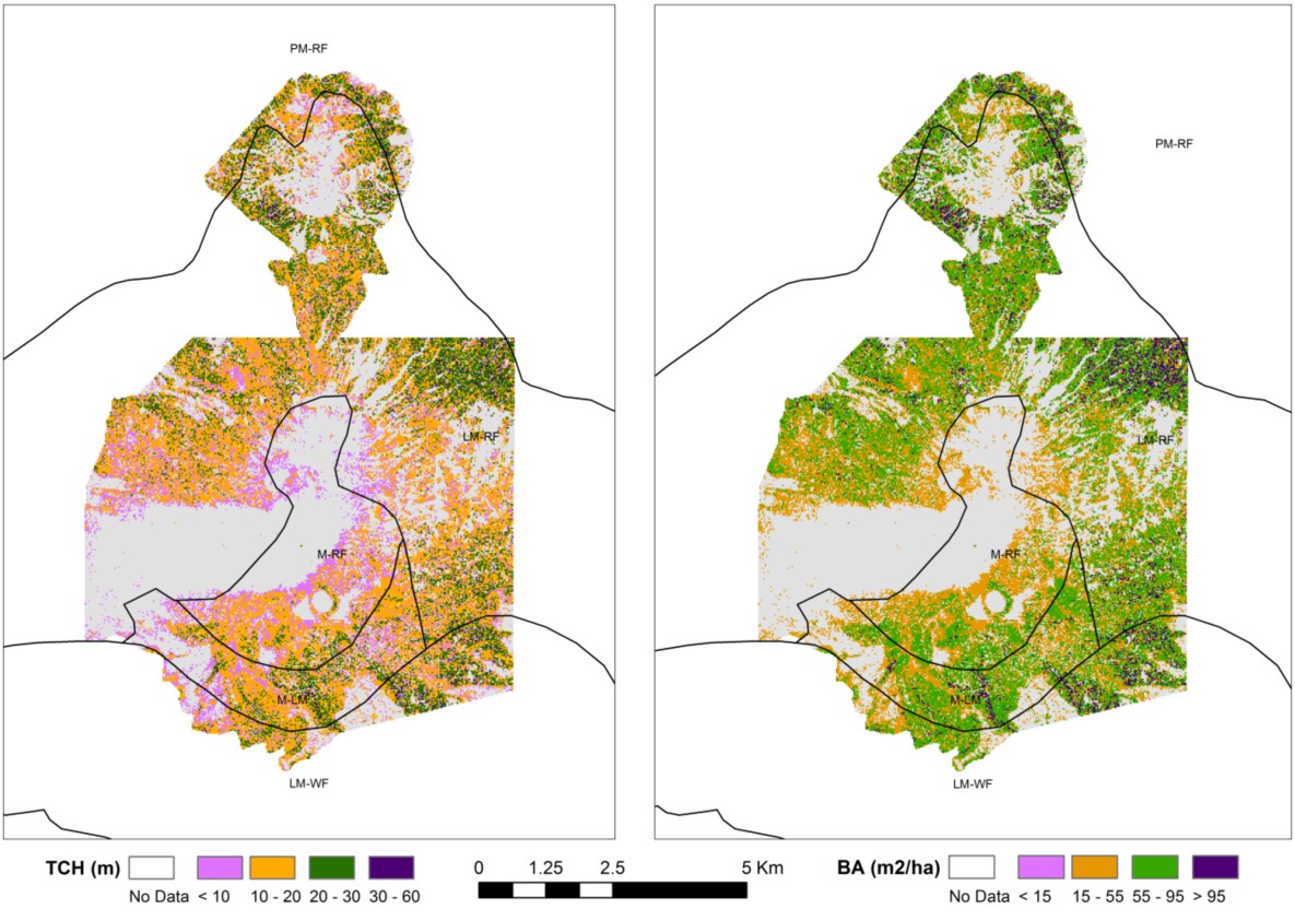
Top-of-canopy Height (TCH) and Basal Area (BA) values for Poás Volcano National
Park (Costa Rica). TCHvalues were obtained through LiDAR data and BA values were
derived from an origin-forced linear regression BA-TCH.
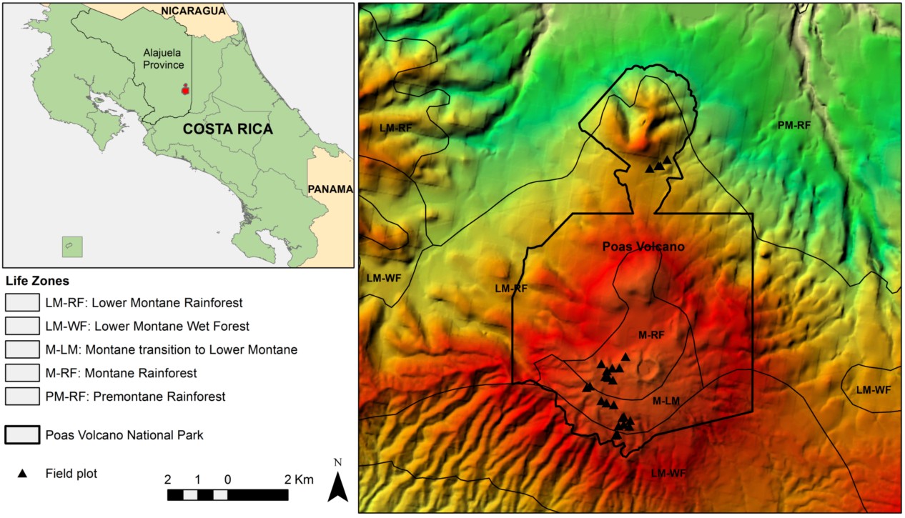
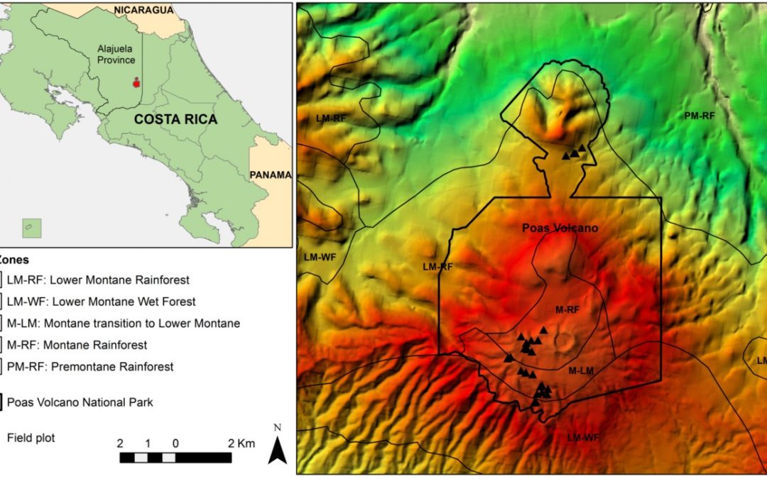
Location of Poás Volcano National Park in Alajuela Province (Costa Rica) and spatial distribution of field plots and Holdrige’s life zones in the area.