Detektia is a startup specialized in infrastructure monitoring from space. They bring satellite data to decision-making in the infrastructure sector. Agresta has been collaborating with them since their begining in 2019.
Detektia remotely measures millimetric deformations of infrastructures and land surfaces. They do not use any type of ground devices, Detektia achieves this by using radar satellite sensors.
If you would like to know more details about how Detektia is able to transform satellite information into early infrastructure deformation warnings, please continue reading.
If you go on reading you will also learn why is so important remote sensing technology in infrastructure monitoring, some interesting details about EyeRADAR, Detektia’s infrastructure management software and a glimpse of the mobile APP that Agresta has developed using its API.
The importance of remote sensing in structural health monitoring (SHM)
Accidents such as the one that occurred in the city of Genoa (Italy) in 2018 where the Morandi Bridge collapsed let us know the importance of infrastrucure monitoring. 43 people died in Morandi Bridge. In 1959, a dam failed in Malpasset (France) where more than 400 people died.
The main aim of structural health monitoring is the follow-up and inspection of infrastructures. SHM provides kind of x-ray of a infrastructure. The data taken from infrastructures allow Detektia detecting any risk and/or deterioration in it.
The generation of early warnings is not limited to the prevention of accidents such as those already mentioned. It also allows detecting any anomalous behavior in advance, for example to reduce maintenance costs and plan the actions to be carried out with enough time.

Ideally, every infrastructure should be monitored in real time. This would make it possible to detect any anomaly on it. The monitoring and auscultation of infrastructures has historically been carried out through the use of ground devices.
Although the data provided by ground devices is highly accurate, there are some important limitations: On the one hand, an installation process is required which is usually quite costly. Reparation and disassembly tasks are also required. In addition, an infrastructure usually requires high number of sensor devices which increases the cost.
On the other hand, the energy available in sensors is usually limited. As a result, the transfer of information and/or communication must be relatively low in order to extend their useful life.
One of the most important features in structural health monitoring is to have real-time information. However, limiting the frequency of data transfer from devices takes us away from this scenario.
Technological improvements of remote sensing and the high availability of satellite images, have completely changed the infrastructure monitoring business. Detektia, undoubtedly belongs to the group of companies that are revolutionizing SHM sector.
The use of DinSAR satellite technology allows Detektia to carry out continuous measurement of millimeter deformations and consequently, the generation of structural health metrics and early warnings.
Candela Sancho – CEO of Detektia
«Our solution helps creating safer and more efficient infrastructures with significant cost savings, reduced carbon footprint and avoid disasters.»
Thanks to the technology developed by Detektia, infrastructure managers can make better decisions during the planning, design or execution of a project.
The main advantage of DinSAR technology for infrastructures monitoring in compisson with ground-based instrumentation is the possibility of monitoring large areas and creating huge volumes of control points without necessarily implying a higher cost.
EyeRADAR, the ultimate all in one SAAS for infrastructures deformation monitoring
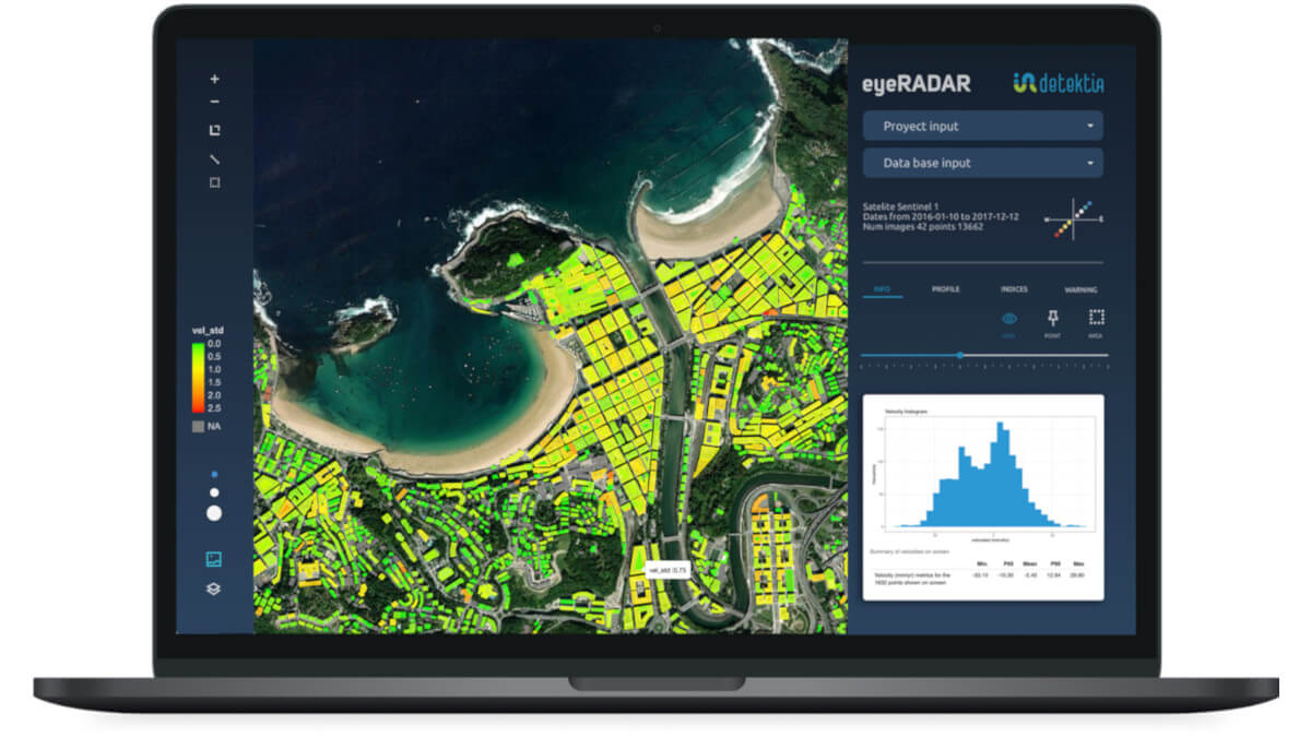
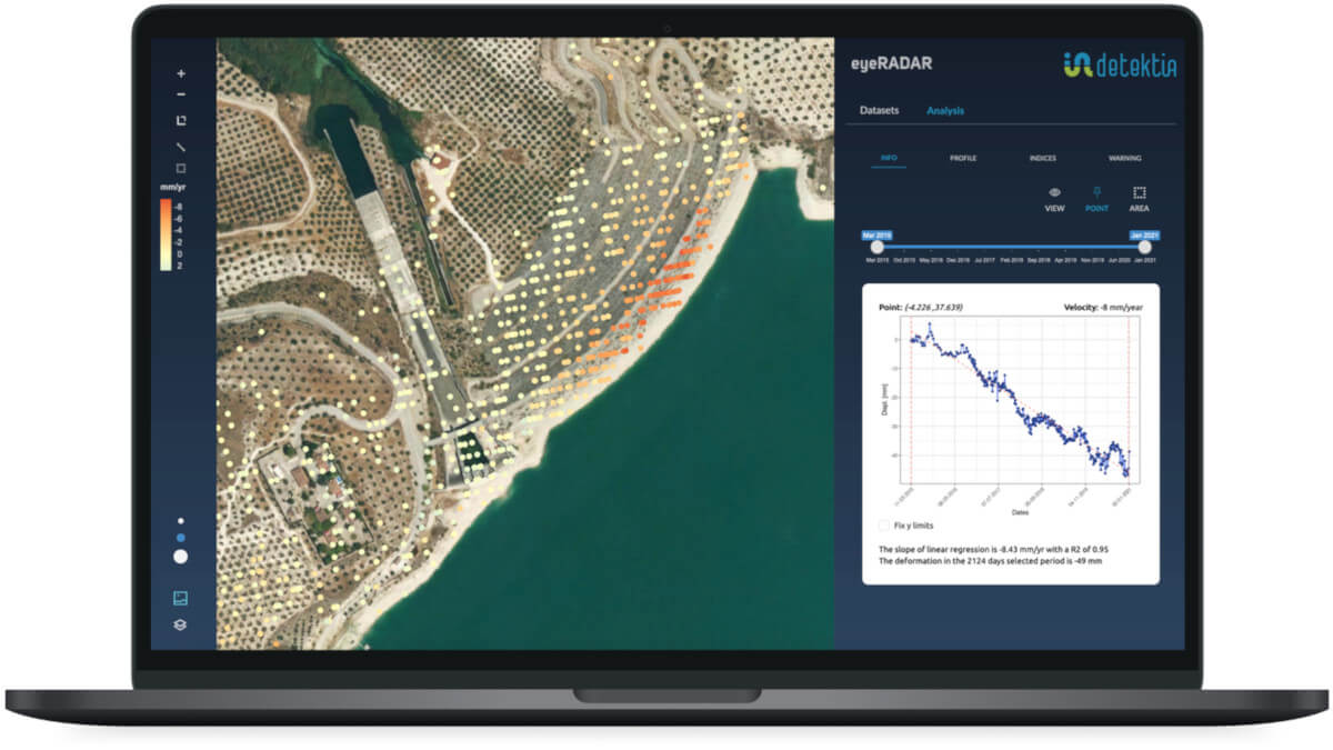
Detektia has developed EyeRADAR web platform which allows users to analyze deformation series, indices and metrics in a very visual and interactive way.
EyeRADAR automatically generates alerts and warnings when custom metrics exceeds specific thresholds. Thanks to this feature, infrastructures managers don’t have to be aware of analyzing the deformation at every update; EyeRADAR alerts them when something anomalous is happening. The alerts and metrics are based on AI models. They help to get a real interpretation of the enormous volume of information generated by satellite radar technology.
EyeRADAR is a software as a service tool (SaaS) that could be easily used in any device without installation, it automatically provides software updates as well as faster and efficient support.
EyeRADAR provides a custom module that lets users integrating it not only with DInSAR data sources. It is compatible with other data sources such as data taken from ground devices (piezometers, accelerometers, inclinometers…) or topography campaigns (leveling, total station, GNSS…) etc.
Would you like to know more about EyeRADAR? Have a look to its website! A free trial is available.
EyeRADAR API: integration with third-party platforms
An API (Application Programming Interfaces) is a software that makes it possible the communication between two or more applications. The API of EyeRADAR lets using your preferal infrastructure management software by taking advantage of every feature provided by EyeRADAR online tool.
That is, by using the API of EyeRADAR you could integrate or connect it with your custom infrastructure software.

Detektia has dedicated a huge effort during 2022 to develope their API. Detektia has been working with Victor Olaya during this process. Victor is a forestry engineer and an important figure thanks to its essential book on Geographic Information Systems. Victor has been working with Detektia on the development of a QGiS plugin for visualization and analysis of DInSAR time series for Detektia.
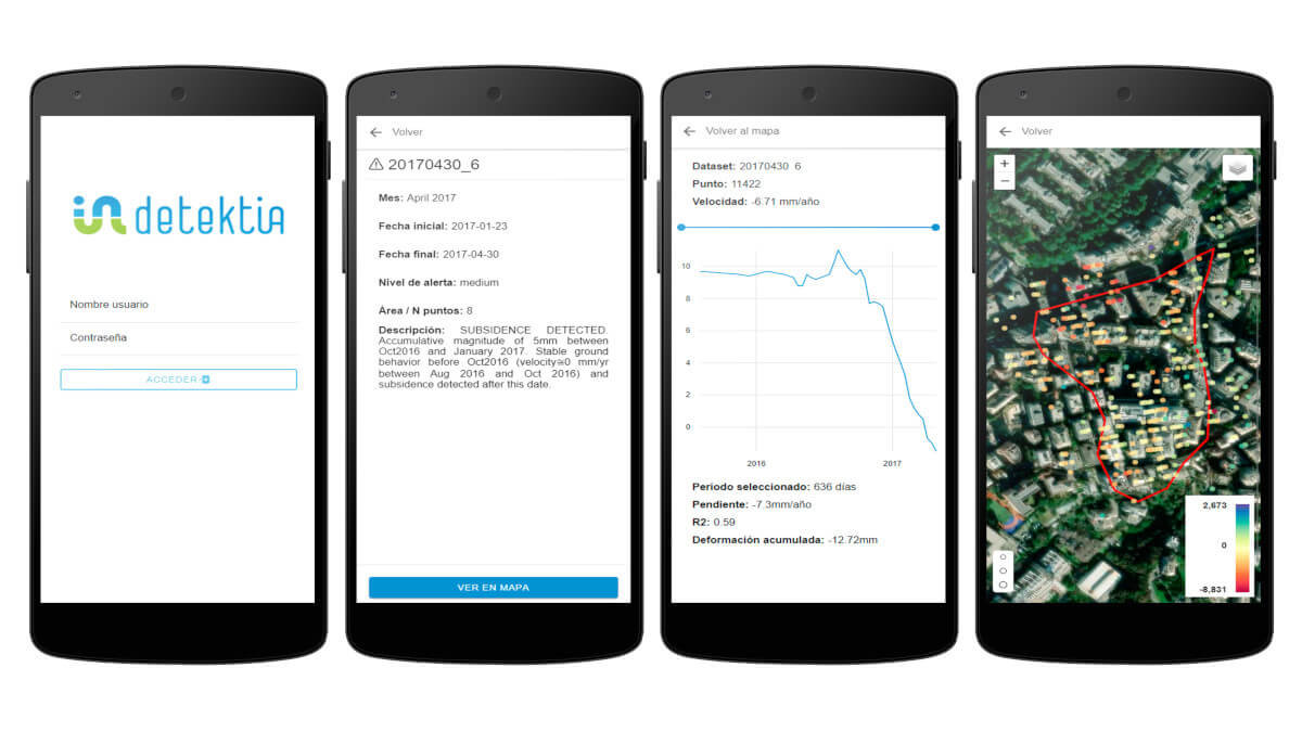
Agresta’s has been testing the EyeRADAR API in order to develop a new mobile application which is actually available for Android devices. It lets users accessing to deformation alerts, know the details of them, locate them on the map and analyze the time series of deformations.

Once the development is finished, we could conclude that the API is very well documented. Thanks to documentation provided by Detektia the integration of EyeRADAR features into other application becomes a really simple task.
A step forward in infrastructure monitoring
The integration of deformation data taken from satellite radar in mobile devices is without any doubts a big improvement in infrastructure monitoring: Infrastructure inspectors could receive notifications on their mobile devices containing deformation alerts. The responsible technicians can review this alert in the field, complement the data with on-site evidence (measurements, photos, comments…) and share this information with the rest of the team.


